“Well, this mountain kicked my ass.” Those are the words my little brother, Dan muttered as we finally neared the summit of Camel’s Hump Mountain. After nearly two hours of steep incline, a few rock scrambles and more tree roots than I can count we were finally getting close to the end of the 3.75 mile trail to the top of the mountain. It was, indeed, a tough climb to the top and it was a relief to know that the end was in sight…well, sort of.
At about 12:30 in the afternoon, my little brother, SCAMP (the dog), Mike and I started our hike up to the top of Camel’s Hump, the third largest mountain in Vermont, part of the Green Mountains and perhaps that state’s most distinctive peak. We were all looking forward to a nice hike to the top of the mountain. Although we should have known it would be tough, we were walking up a mountain after all, we really didn’t know what we were getting ourselves in to as we started out on a single track dirt trail.
We quickly fell in to three separate hiking patterns: Mike hiking ahead with SCAMP, Dan not far behind and me bringing up the rear. The trail went up, up, up relentlessly and we took a break for water and to catch our breath when the trail intersected with the Dean Trail.
At this point, we fell in to a new routine: Mike still hiking ahead with the dog, Dan ambling along the trail and me some where in the middle attempting to keep up with Mike and the dog without losing track of Dan. One of the things I love about hiking is that it satisfies my contradictory desire to be both alone and with our people. As we hiked we did very little talking, we weren’t even in sight of one another for a majority of the time, and yet, I loved that we shared this experience.
Most people would think that hiking up a mountain, being constantly out of breath and having to scramble up and over rocks sounds like a form of punishment or torture but I love it. Getting to the top of a long trail up a mountain is a uniquely satisfying feeling. It is filled with triumphs (yay, I made is to the top of this climb) and moments of renewed determination (but I have miles more to go). There are rewards – a sudden clearing of the trees at a beautiful vista of the mountains surrounding you – and moments of quiet reflection as you walk through a forest that has been around longer than you can imagine.
This hike did not disappoint in any of these regards. There were very few switchbacks up this mountain, just a relentless incline through the forest and over the rocks and roots. Most of the time we were under tree cover, which kept us relatively cool, but there were a few spots where we out in the sun. It was actually a pleasant day for hiking (I know most Vermonters would probably say it was hot since it was up in to the 80s but considered there was little humidity and that all I’ve had for the past few weeks is to sticky, gross upper-90s in DC, I thought the temperature was refreshing).
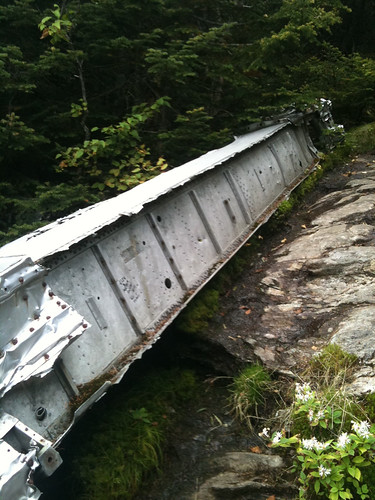
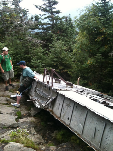
Nearing the top of the mountain and just over three miles, we started to keep our eyes out for the short side trail that would take us to the wing of a B-24J bomber. In 1944, during World War II, the bomber was out on a training run and crashed in to the mountain. The plane (and the several crew members who died) was eventually recovered with the exception of the wing which sits just off the Monroe Trail.
The wing has weathered the 60-plus years on the mountain well but it seems so out of place in this setting. It is definitely one of the most unusual things I’ve encountered out on a hike.
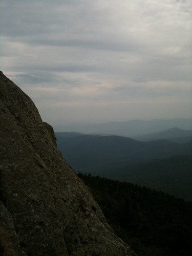
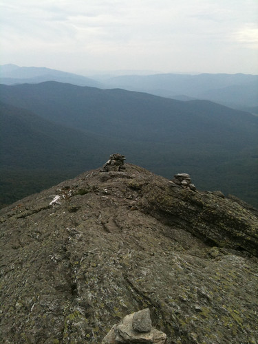
Not long after the seeing the wing, we finally reached the alpine zone and the summit. It was a relief to finally reach the top; we were tired of going up. I was surprised by two things at the top of the mountain: 1) at some point during the hike, the clouds had rolled in and it was overcast and 2) it was super windy. As a result, it felted like we had hiked out of one day and in to another.
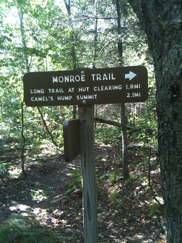
Following a hike description we found online, we decided to hike the Long Trail down the mountain, hook up with the Dean Tail after about a mile and then get back on the Monroe Trail a bit under 2 miles from the trail head. As it turned out, this ended up being a bit of a misstep on our part. Since everyone was exhausted from the trip up we probably should have just stayed on the Monroe Trail, retrace our steps back to the start. However, we decided to brave the unknown.
This section of the Long Trail ended up being quite difficult. There was a great deal more rock scrambling and one point we even had to carry the dog over a section of rock. It was a tough hike down because of the steepness and the fact that we weren’t sure we were on the right trail at one point, plus it took us longer to climb down that we anticipated so there were some tense moments before we finally popped out on the Dean Trail and then saw the sign for the Monroe trail and the parking area.
Despite the exhausting climb down (oh man, my quads were toast from the climb up so they were nearly shot for all the downhill stuff), I think the Long Trail portion would have been an awesome climb up. It would have been steeper and tougher, with more hands and knees rock scrambling but it would have been fun to tackle those sections with fresher legs.
We finally made it back to the trail head, all four of us completely spent. It was a fun hike and I highly recommend it for anyone who’s in good hiking shape. I’d love to do it again.
Subscribe to:
Post Comments (Atom)

1 comment:
That old plane wing is actually off the Alpine trail. The Alpine trail intersects with the Monroe trail about two thirds of the the way up and takes a slightly different route to the top.
Post a Comment